How Big Data Is Helping Snuff Out California's Wildfire Epidemic
California is currently in the grips of a major drought, one of the worst of this generation. The region’s lack of precipitation has not only hindered California’s agricultural industry, it’s also turned our forests into tinder. But researchers at the University of California San Diego have a potential solution: just wire up all the trees to the Internet of Things.
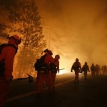
Wildfires are a common occurrence in California and, under normal conditions, play a vital role in maintaining the health of our forests by clearing out dead plants and trees, thereby freeing the nutrients locked within them. But thanks to a rapidly warming environment and a vicious drought, the rate and destructive ferocity of wildfires throughout the state have exploded in recent years.
They aren’t just burning out dead acreage anymore; they’ve decimated thousands of square miles of forest and suburbia. The Poinsettia Fire just outside San Diego in May scorched more than 2000 homes and caused upwards of $22 million in damages alone. That’s just one fire. And as of this post’s publication, the state is currently fighting three more.
And that’s where the WIFIRE system comes in. Developed by researchers at UCSD in collaboration with a team from the University of Maryland, and funded by a $2.6 million ongoing grant from the National Science Foundation, the scalable end-to-end cyberinfrastructure system is designed to monitor forest conditions, predict when and where a wildfire is most likely to occur, and and mitigate the damage they cause by alerting officials within seconds of their outbreak.
The WIFIRE system, which entered development late last year, leverages a combination of local sensor data cataloging and satellite imagery analyzed in UCSD’s Supercomputer Center to generate dynamic, real-time wildfire modeling.
“Real-time measurements on the areal location of a wildfire and current wind speeds can be combined with topography information to estimate and update information on fuel content and the rate of spread (ROS) of the wildfire,” Raymond de Callafon, director of the System Identification and Control Laboratory at UC San Diego, said in a press statement. “Monitoring and predicting the ROS is possible by combining signal processing, parameter estimation, and dynamic wildfire models to update the state of the wildfire in real-time. WIFIRE combines the unique research expertise on signal processing and parameter estimation at MAE with wildfire modeling and state estimation at the University of Maryland’s Department of Fire Protection Engineering.”
As the NSF grant award page explains:
The WIFIRE CI integrates networked observations, e.g., heterogeneous satellite data and real-time remote sensor data, with computational techniques in signal processing, visualization, modeling and data assimilation to provide a scalable, technological, and educational solution to monitor weather patterns to predict a wildfire’s Rate of Spread. Our collaborative WIFIRE team of scientists, engineers, technologists, government policy managers, private industry, and firefighters will architect and implement CI pathways that enable joint innovation for wildfire management.
Scientific workflows will be used as an integrative distributed programming model and will simplify the implementation of engineering modules for data-driven simulation, prediction and visualization while allowing integration with large-scale computing facilities.
“WIFIRE will be scalable to users with different skill-levels using specialized web interfaces and user-specified alerts for environmental events broadcasted to receivers before, during, and after a wildfire,” Ilkay Altintas, principal investigator for the WIFIRE project and SDSC’s deputy coordinator for research, explained. “This approach allows many sensors to be subjected to user-specified data processing algorithms to generate threshold alerts within seconds. Integration of this sensor data into both rapidly available fire image data and models will better enable situational awareness, responses and decision support at local, state, national, and international levels.”
The idea for the WIFIRE system did not spring forth from Altintas’ mind like a computational Athena. It actually grew out of the state’s existing Area Situational Awareness for Public Safety Network (ASAPnet). This array of wireless nodes connects five dozen regional backcountry fire stations in a network monitoring conditions within the forests.
“San Diego County is already well positioned to monitor and analyze these dynamics through sensors within and outside of our research networks,”High Performance Wireless Research and Education Network (HPWREN) co-founder Hans-Werner Braun said in a press statement. “We have been collecting environmental data for more than 10 years through HPWREN, merging large volumes of data and computational models into sophisticated visualizations, and have forged new networks through government and industry partners including CAL FIRE, the U.S. Forest Service, San Diego Gas & Electric (SDG&E), and the San Diego County Emergency Operations Center to direct and share our research.”
And with WIFIRE starting its initial operational trials by January 2015, the defensive ‘net covering California’s valuable forests will only get better and hopefully help state fire officials get a handle on what’s become a routinely deadly fire season. [NSF 1, 2 – UCSD]
The Cloud Server So Large They Should Call It “Hurricane”The Cloud Server So Large They Should Call It “Hurricane”The Cloud Server So Large They Should Call It &…
As computational-heavy research gains momentum, the amount of data researchers generate is exploding—a single sequencing of DNA requires as much as… Read more
Continue reading:
How Big Data Is Helping Snuff Out California's Wildfire Epidemic